A quick conference trip to Mexico – with the Tern Verge S27h folding bike

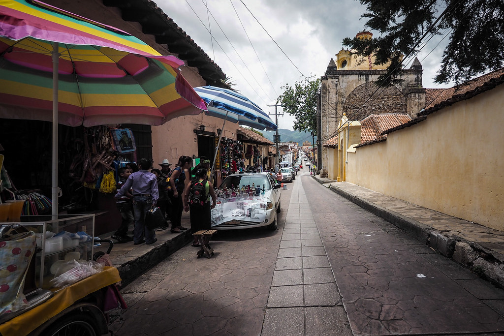
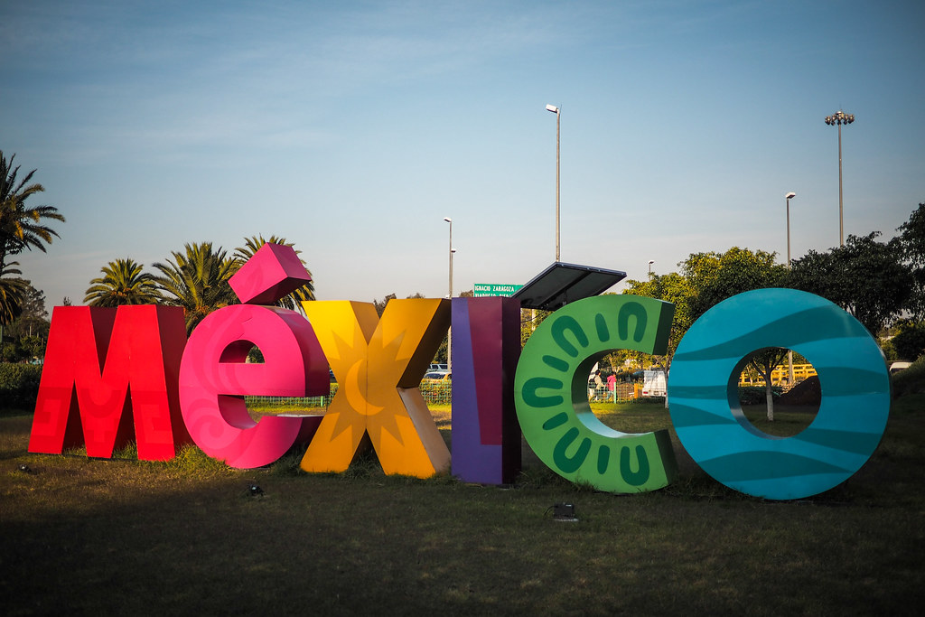
A few months back I traveled to southern Mexico for the International Association for Cross Cultural Psychology conference in San Cristobal de las Casas in the Chiapas region. I was there to do a couple of talks about my own research in Japan. It was a real fly-in fly-out sort of conference – I was only in Mexico for four days, three of which were taken up by the conference.

Mexico City, Mexico

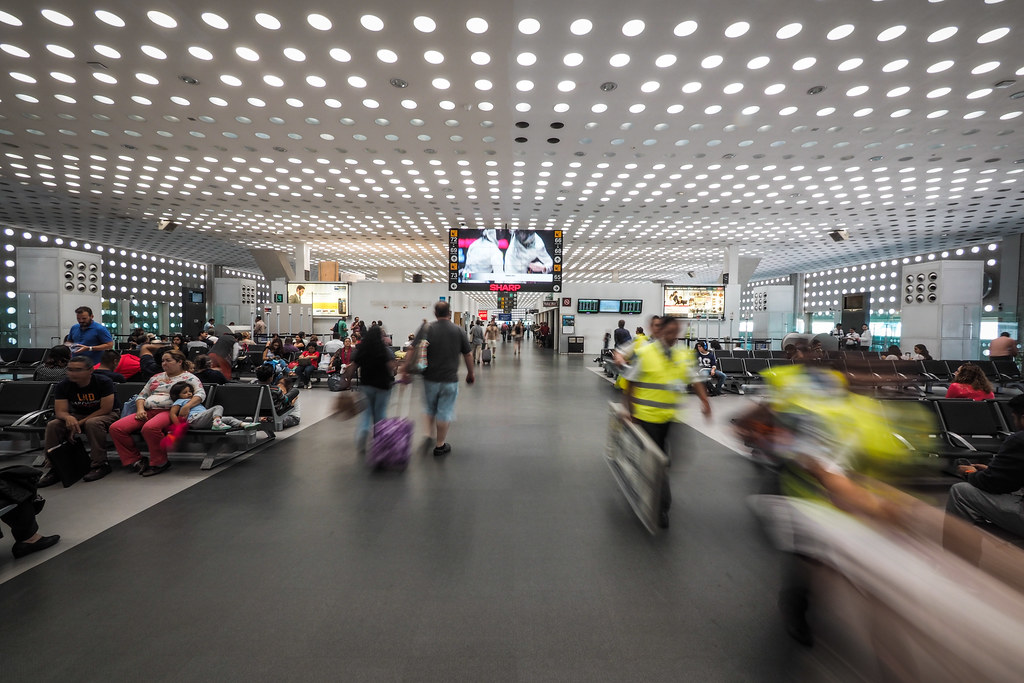
Despite the really tight schedule, I decided to take my Tern Verge S27h folding bike (in  suitcase), so that I might find a little bit of time to explore the outer areas of the city of San Cristobal de las Casas. Sitting in the terminal building at Mexico City airport, waiting for my fourth flight in order to get to the Chiapas region from Japan, I was feeling impatient…itching to jump on a bike for a first ever bike ride in Central America.

San Cristobal de las Casas (Mexico)

In the end all I did was a three-hour bike ride early in the morning on the first day of the conference: up before dawn and back in time for the first speaker at 9am. Accordingly, the city was still well and truly asleep by the time I got out in the morning.

San Cristobal de las Casas (Mexico)

San Cristobal de las Casas (Mexico)

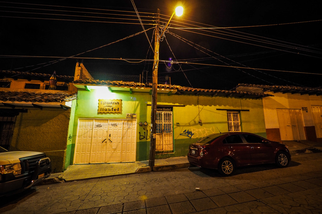
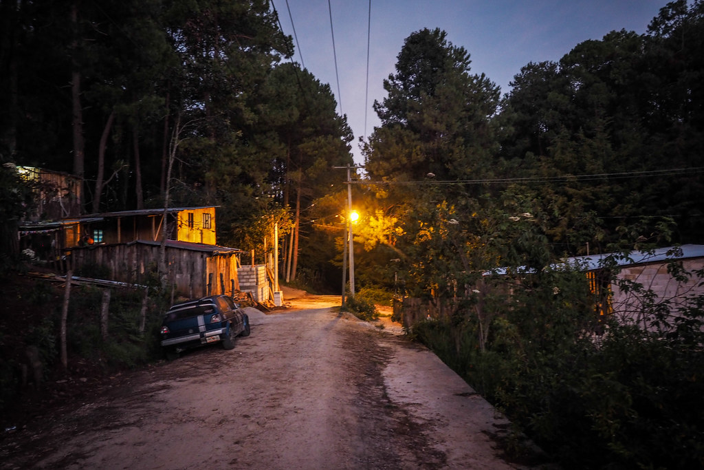
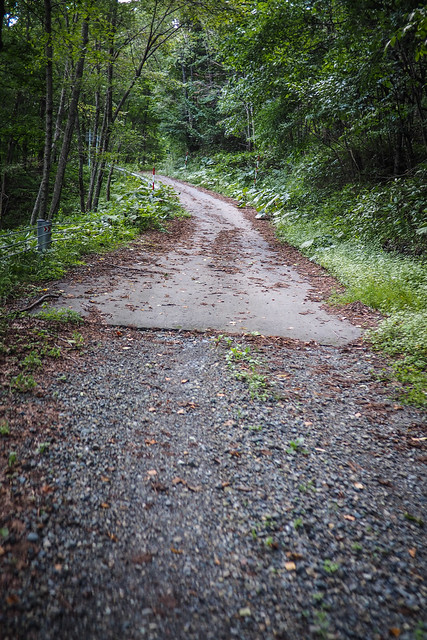
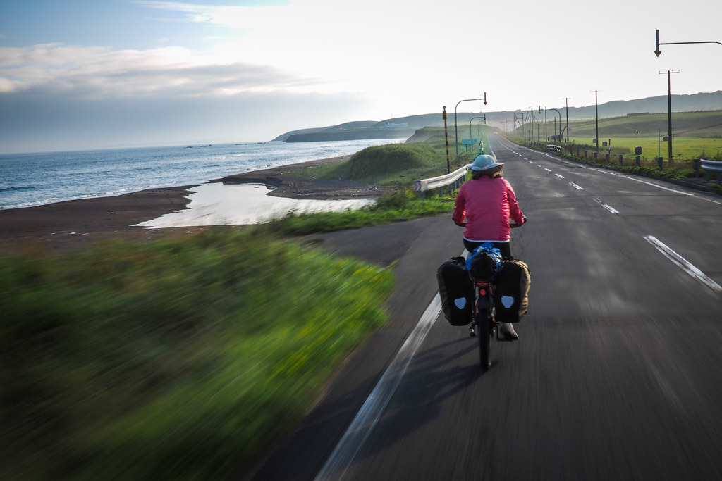
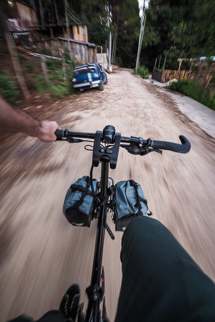
I followed a few deserted streets out until I hit dirt roads, and carried on towards the outer east-side of the city.

Dirt road south of San Cristobal de las Casas, Mexico

 By around 6:30am the outskirts of the city were waking up. Cheerful locals, all heading in the direction of the center of the city greeted me as I cycled past.

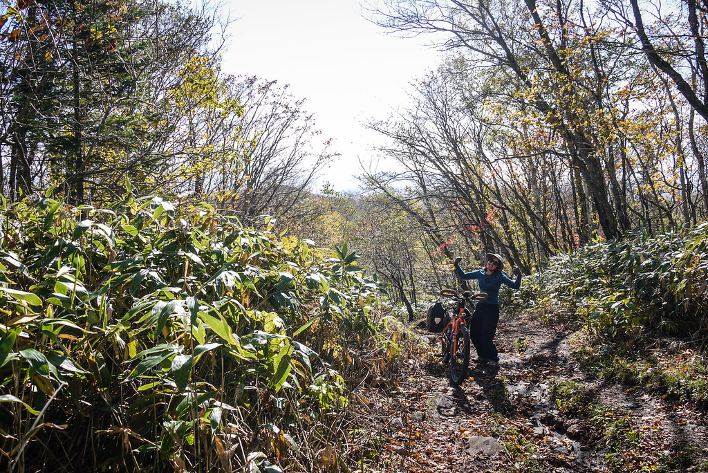
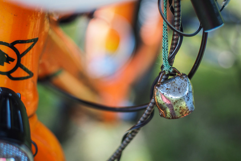
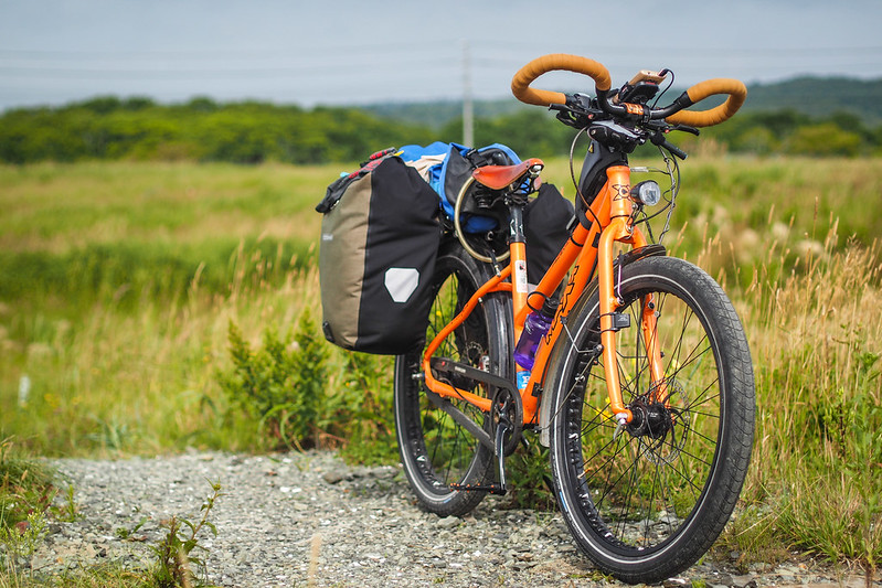
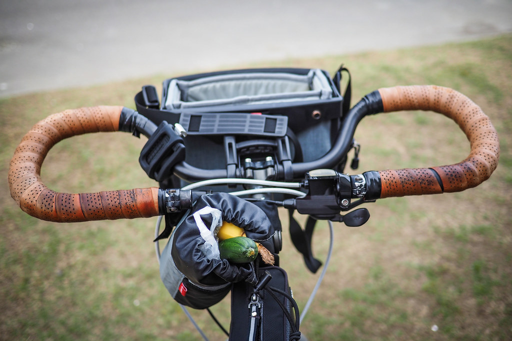
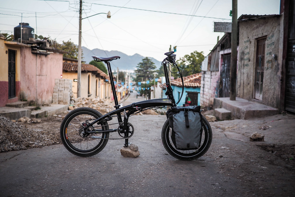
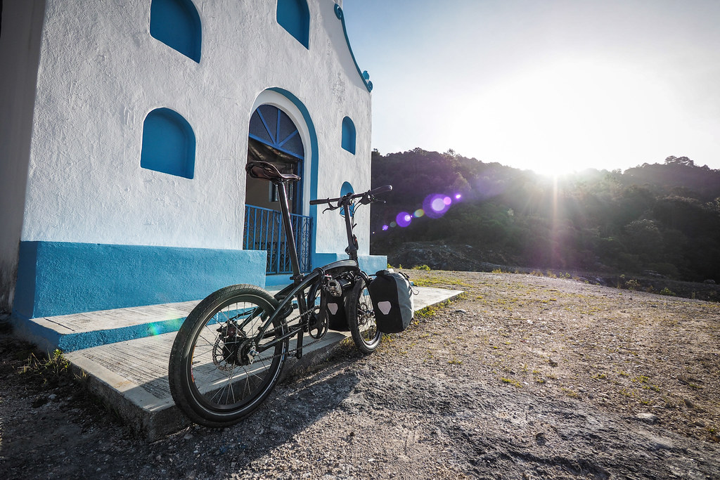
I took the chance to take a few pics of the way I had the bike set up for this very bare-bones trip. No rear rack for this trip…just the bare essentials.

Tern Verge S27h in San Cristobal de las Casas (Mexico)

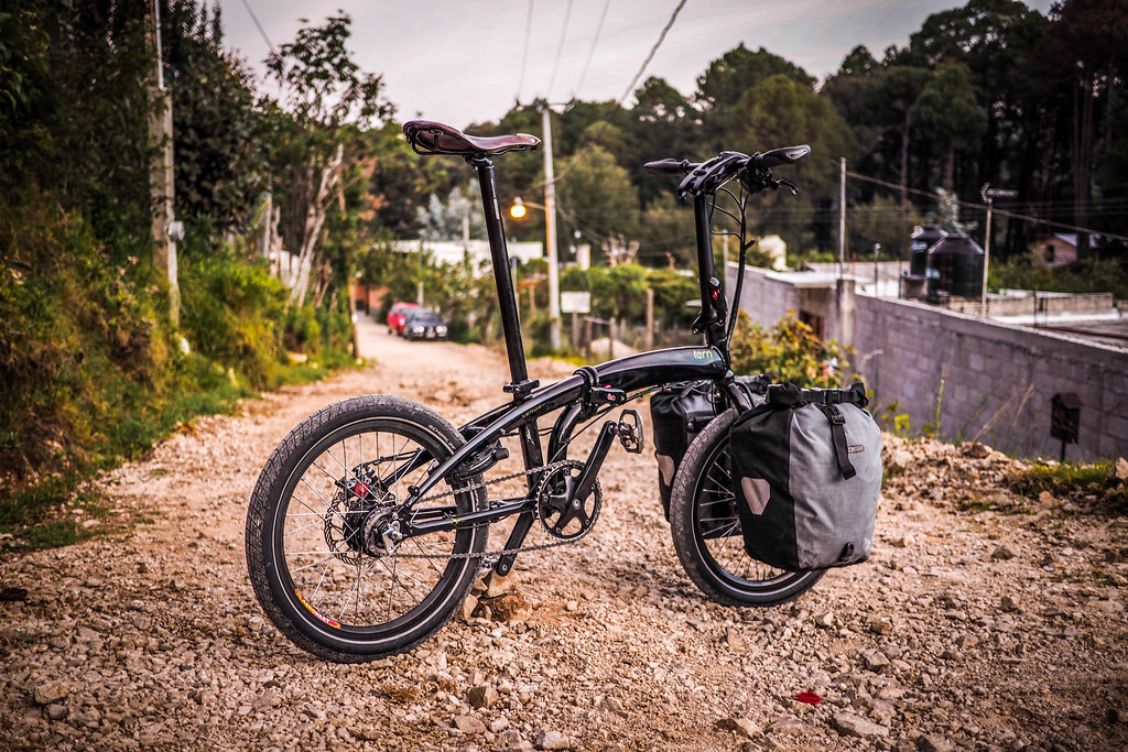
As always, the Tern Verge S27h is great fun to ride on gravel. Despite the small wheels, the fat Schwalbe Big Apple 2.15 tires smooth out the bumps. Just watch out for potholes…they’ll swallow those small tires whole!

Tern Verge S27h in Mexico (San Cristobal de las Casas)

Tern Verge S27h in Mexico (San Cristobal de las Casas)

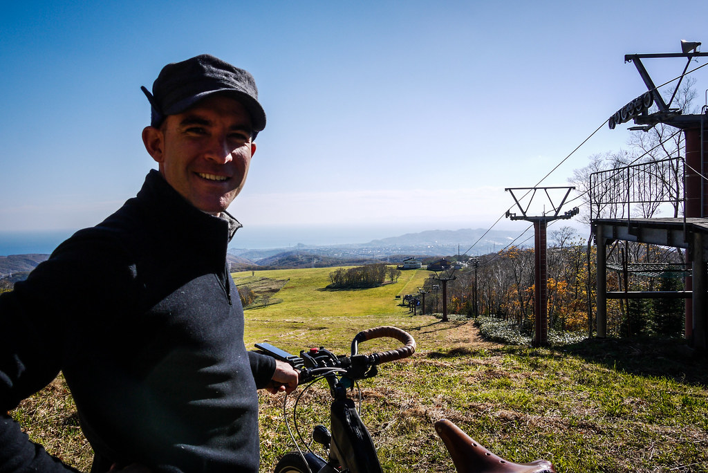
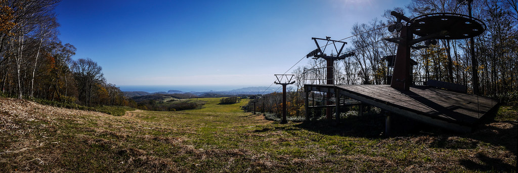
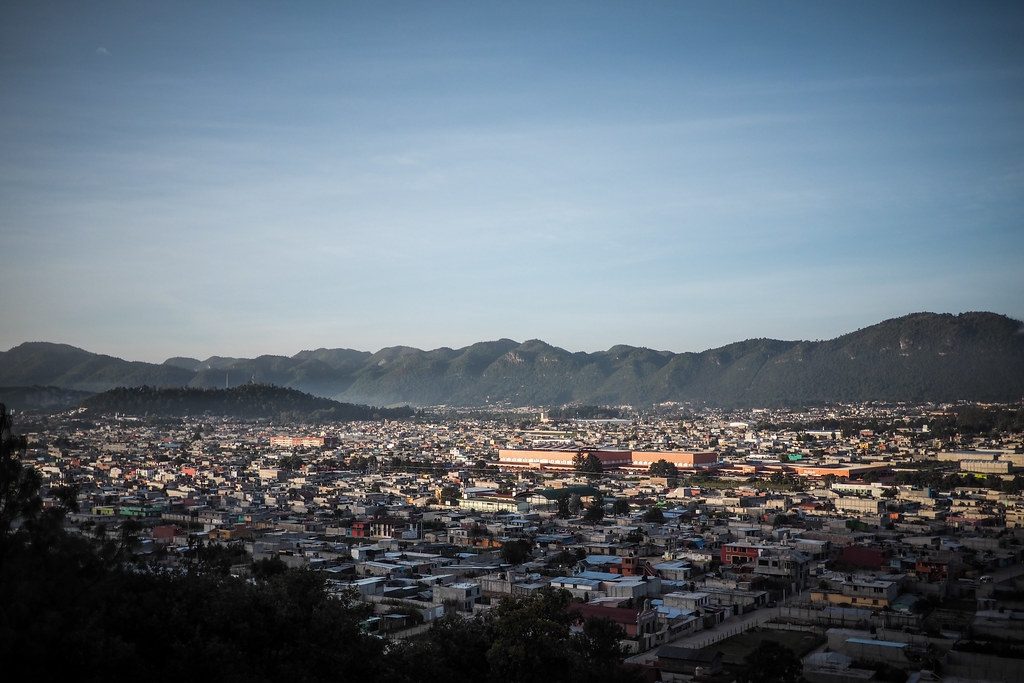
I back-tracked a little to the west, and took a northerly ring road around the city, and followed my nose up a steep hill to a spot overlooking the city. At an elevation of 2,200m above sea level, it was a brisk but clear morning.

San Cristobal de las Casas (Mexico)

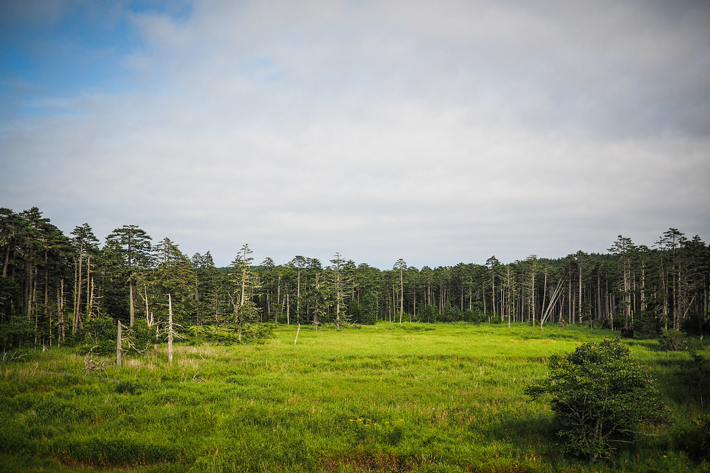
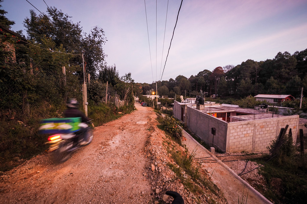
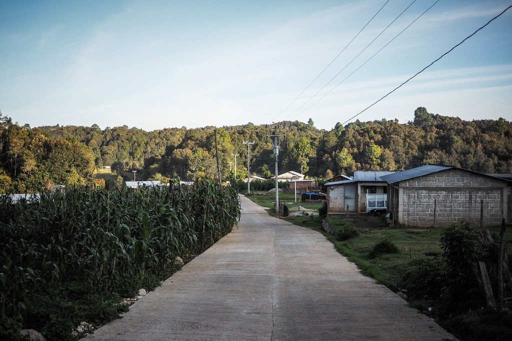
Heading further up the hill, I found myself in largely indigenous locals’ areas…small farmlets and the smell of woodsmoke…and locals a little more stand-offish.

San Cristobal de las Casas (Mexico)

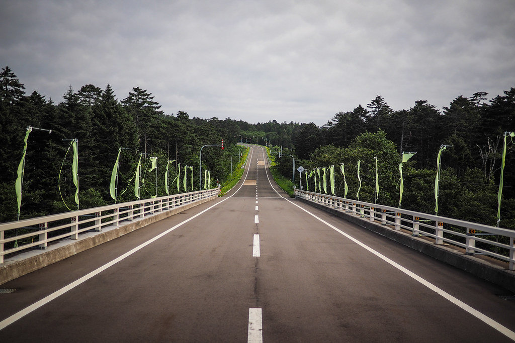
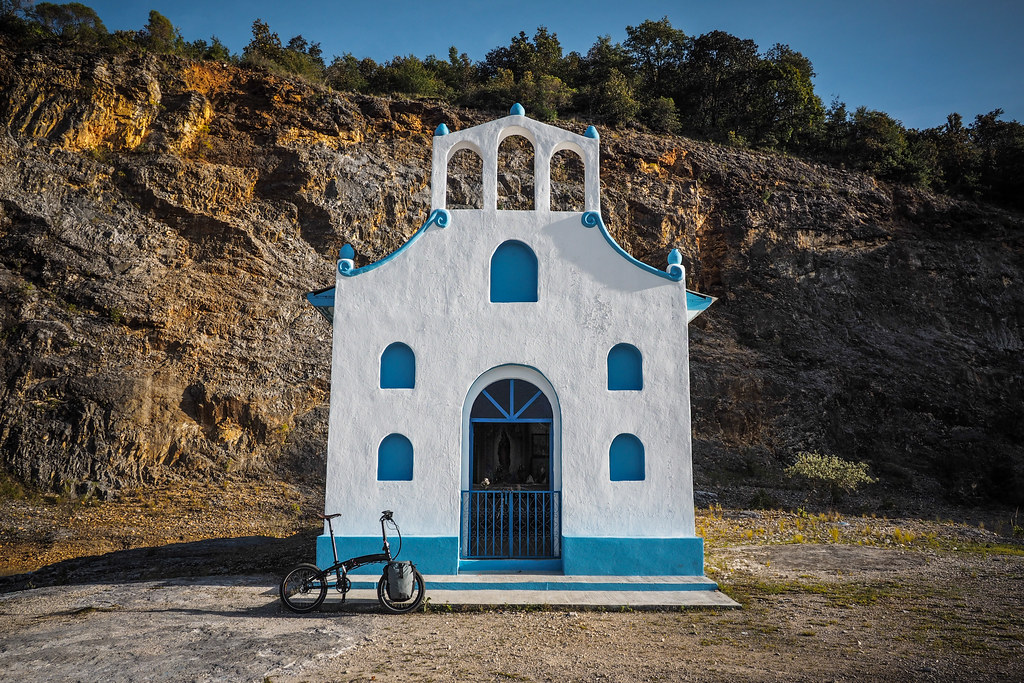
By this time it was getting close to 8:30am, and I had to high-tail it back to the conference venue for the first talk of the morning. The road I was on looped back downhill, back past a beautiful church, brilliant white against a quarry background.

San Cristobal de las Casas (Mexico)

Tern Verge S27h in Mexico (San Cristobal de las Casas)

From there it was a screaming downhill back to the city center, where I headed straight for the conference venue, arriving just in time for the start of the morning session. For which it seemed many registered participants had not bothered getting up!

San Cristobal de las Casas (Mexico)

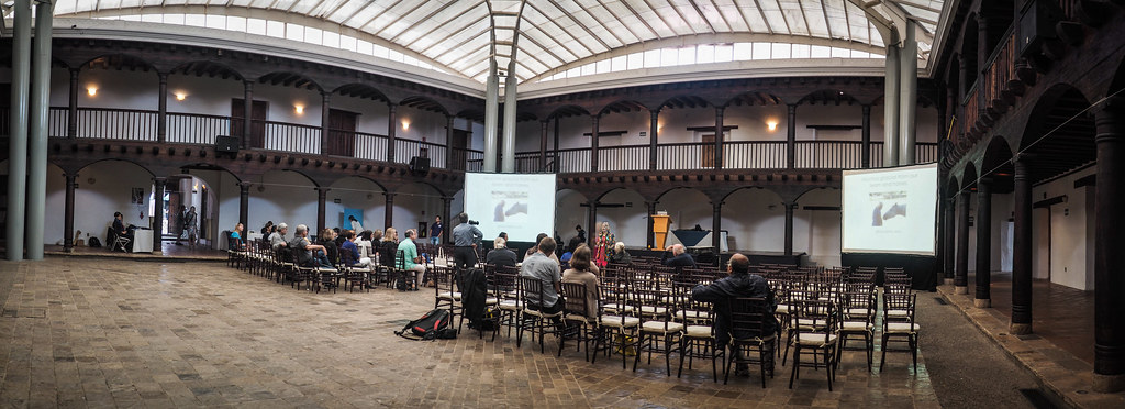
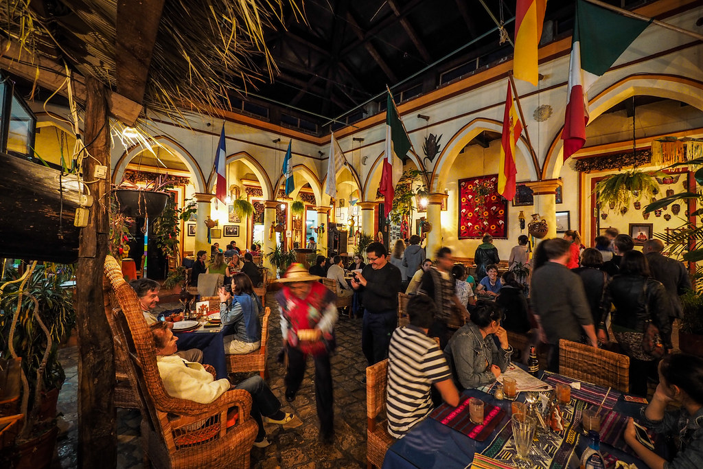
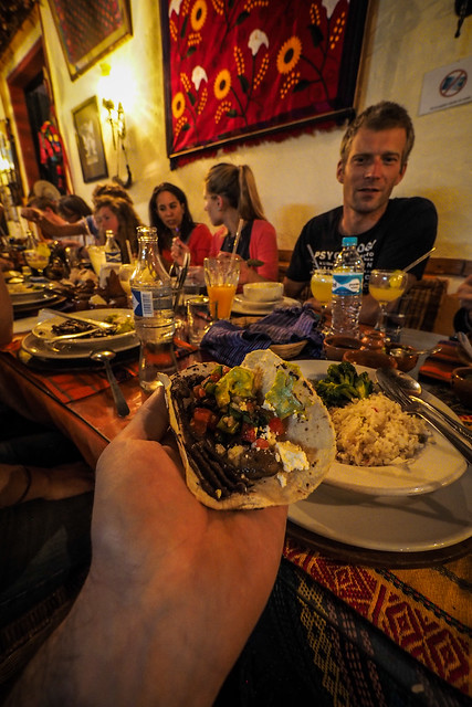
The rest of the four days consisted of two presentations that I had been accepted for, and listening to some other great research by others in the cross-cultural psychology field. Along with, of course, plenty of opportunities to network and make new friends and collaborations, whether it be over a civilized dinner…

San Cristobal de las Casas (Mexico)

San Cristobal de las Casas (Mexico)

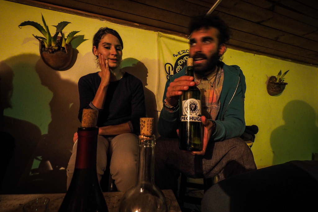
Or over shots of home-made smoked tequila…this stuff tasted more or less like the smell of the fuel I put in my alcohol stove….

San Cristobal de las Casas (Mexico)

Overall it was a great few days which left me wanting to get back to this area of the world for a more thorough exploration by bike.

San Cristobal de las Casas (Mexico)

Hike ‘n biking in Muroran City: The MIT – Dan Para Loop

“I never considered Muroran high on my list of places to live,” Haidee mused a few weeks back. She had just landed a job at Muroran Institute of Technology (MIT) as associate professor, and we were in the process of sorting out a place for her to live there. And I couldn’t help but agree; I’d only ever considered the south-eastern coast of Hokkaido to be windswept, bleak, and rather non-descript. Muroran City itself hadn’t stood out to me as much better. The eastern part of the city involves large swathes of reclaimed land now home to heaving steel foundries, and the place seems to constantly bear the brunt of chilly ocean winds.

Interestingly, however, many of Haidee’s new colleagues did nothing but rave about the place. “This place is paradise,” said one chap from Canada who surfs all year round. The same chap also extolled the great network of mountain biking trails in the hills north of the city. From all indications satisfaction with life seems to be at an all time high with those who live here.

So on my weekend visit this week, I decided to bring my bike on the train so that Haidee and I could explore a little around where she lives near the university (I still live in Sapporo, 1.5 hours by train from Muroran). And long story short, our little excursion today gave us a fresh new perspective on this fascinating city.

We had initially decided on a whim (at around 10am) that we would spend the day climbing Mt. Muroran. This 911m high mountain stands directly to the north of the city; you can’t really go up a hill for very long in Muroran City without eventually getting funneled into a valley that heads up towards the summit.

After an hour of cycling up to the beginning of the walking track (at 450m), however, we were starting to get content with our vertical gain efforts, and decided to head back down. The walking track starts at the Muroran Dan Para Ski Field, so we ate the sandwiches we had on hand in the shelter of the ski field buildings.

It was in one of these buildings that I noticed an old hand-written map that indicated it might be possible to connect the ski field with an old forestry road that weaves its way up the valley where Haidee’s apartment is. Essentially the ski field is at the upper confluence of two valleys; Haidee’s valley and the next valley to the west. If we were able to get to the forestry road from the ski field, we’d have a gravel road downhill straight back to Haidee’s place.

We decided to take the challenge on, and this culminated in ‘discovering’ a very nice and varied “MIT – Dan Para Loop”.

From the ski field buildings it was a short 15 minute bike/hike up the Mt. Muroran hiking trail, past the hakuchou hut (白鳥ヒュッテ) to where the koudai tozan-ro (工大登山路)  walking trail starts on the right of the trail (at the top of the ski field chairlift).

Mountain biking the Mt. Muroran track, Muroran, Japan

Tanpara Ski Field in autumn (Muroran, Hokkaido, Japan)

Muroran Dan Para Ski Field in autumn (Muroran, Hokkaido, Japan)

From here it was all downhill on single-track.

Mountain biking the Mt. Muroran track, Muroran, Japan

Some perfectly rideable…

Mountain biking the Mt. Muroran track, Muroran, Japan

But most in the realm of “get-off-the-bike-and-ease-it-down”…knobbly tires probably would have helped to no end, of course.

Mountain biking the Mt. Muroran track, Muroran, Japan

Mountain biking the Mt. Muroran track, Muroran, Japan

Hike 'n bike on the Mt Muroran track, Muroran, Japan

Hike 'n bike on the Mt Muroran track, Muroran, Japan

The foot track did eventually link up with the mizumoto forestry road, however, and we were very soon wending our way through autumn leaves straight back down to Haidee’s place.

Cycling the mizumoto Forestry Road, Muroran, Japan

Upper reaches of the Washibetsu River, Muroran, Japan

The bike ride left us feeling that Muroran City is a bit of a dark horse: less than 10 minutes on the bike from Haidee’s place we can be deep in the hills. A two-hour bike ride takes us across a couple of ridges and affords expansive views over the city and harbor.

We’re very much looking forward to winter here; snowshoeing tour from door to door, taking in some of the best pacific views in Hokkaido, anyone?

Today’s approximate route

From Muroran Institute of Technology to Dan Para Ski Field:

Then cut across the top of the ski field, slip and slide down the valley to the forestry road, and…

BIG topographical map of the look route

Muroran Kodai (Institute of Technology) - Dan Para Loop - 2 hours by mountain bike (Muroran, Hokkaido, Japan)

Cycling Across Hokkaido, Japan (Day 13): Hidaka to Hobetsu

Route for today: https://goo.gl/maps/M6lbg

There are some great cycle shops in Sapporo City, where Haidee and I live. Some are better than others, and usually it’s not the stuff they stock that makes them great. It’s the people working there. Nakamura Cycles is one such shop. Mr. Nakamura himself – the owner – seems stressed most of the time and always in a rush, so I’ve never had much of a conversation with him. But Ken Sarai, one of the long-time mechanics at the shop is a great guy, and often has nice tidbits of information for great bikepacking routes in Hokkaido. One time I was in the shop talking to him about Haidee and I’s ill-fated Hobetsu adventure, and he mentioned in passing a place called Niniu. “It’s like a forgotten world,” he described it. “Like they just dropped their tools and left.”

Looking the place up on my map back at home, the area did look interesting. A warren of half-finished closed and unconnected roads, with one massive new expressway bypassing the lot. I decided I just had to visit there some day.

And that day was today.

No sooner had we turned off the main road past Shimukappu did we find ourselves in an eerily deserted world. There had obviously been some serious public work done in recent history, but now the place looked abandoned.

Road towards Niniu, Hokkaido, Japan

The only traffic we saw for most of the morning was a postman Pat-esque red postal van scurrying around the winding track.

Gorgeous river valley near Niniu, Hokkaido, Japan

The wild river was a refreshing sight, even here in Hokkaido, where hillside reinforcing and retaining walls often mar the landscape.

We really felt like we had the road to ourselves.

Road towards Niniu, Hokkaido, Japan

We had originally entertained the idea that we might be able to get to Hobetsu Campground – our destination for the night – by lunchtime. By lunchtime we were still meandering along our own private road, so we stopped in at the Niniu Campground to find shade and a spot to cook up some pasta for lunch.

The campground charged a 200 yen per person day use fee, but it was well worth it. We spent about two hours lounging in the cool shade of the trees.

Niniu Campground, Hokkaido, Japan

After lunch it was bear-bells on the handlebars…

Bearbell on Haidee's bike in Niniu Campground, Hokkaido, Japan

And onwards towards the beginning of a 10km stretch of abandoned, now closed-to-traffic road.

The deserted road beyond Niniu Campground, Hokkaido, Japan

Skirting the closed road near Niniu Campground, Hokkaido, Japan

The bear bell, in case you were wondering, is to let bears know we are coming. The brown bears of Hokkaido are ever so slightly smaller cousins to the American grizzly, so erring on the side of caution when venturing into not-so-often-trod areas of Hokkaido. And by the looks of things, not many people had come this way in a while.

The closed road near Niniu Campground, Hokkaido, Japan

The closed road near Niniu Campground, Hokkaido, Japan

The closed road near Niniu Campground, Hokkaido, Japan

The closed road near Niniu Campground, Hokkaido, Japan

It was a curious sort of road. Clearly there had been great intentions to make it a two-lane route: In parts, there were big wide two-lane bits of road. In others places it was paved single lane, and yet others were just gravel. Curiouser and curiouser.

The closed road near Niniu Campground, Hokkaido, Japan

As we were clambering around the road-closed gate, we saw about 20 university under-grad cyclists (at least they had that air about them) grind up the incline towards Hobetsu campground. Upon asking a couple of them (two who had fallen by the wayside, exhausted), they confirmed our wondering: they were a group of 50 cyclists, all headed for the same campground.

As we inched up the uphill, some of the fitter-looking members were flying back down on pannier-less bikes, only to appear from behind us moments later powering back up the hill with someone else’s pannier strapped to their bikes. They obviously had a mix of abilities in the group…

Hobetsu Dam, Hobetsu, Hokkaido, Japan

Soon enough we rolled up to the Hobetsu hotspring spa (not the photo above…that’s Hobetsu dam). There were exactly 50 bicycles parked out front. We played the waiting game, and sat around outside for 30 minutes in the shade. By the time 30 minutes was up, the university students were trickling out. The strategy worked. We were able to enjoy a very nice soak in the hotsprings sans gaggles of undergrad cyclists.

We’ve stayed in Hobetsu campground before. It is one of the nicer campgrounds we’ve stayed in. Very nice management, and nice facilities.

Hobetsu Campground, Hokkaido, Japan

Although last time we were here, we didn’t have the company of a cheeky fox. This guy was happy to pester us from about a meter away until he figured out we weren’t giving him any food.

A cheeky fox at Hobetsu Campground, Hokkaido, Japan

A cheeky fox at Hobetsu Campground, Hokkaido, Japan

A cheeky fox at Hobetsu Campground, Hokkaido, Japan

After posting photos of him on Facebook that night, we learned that around 50% of foxes in Hokkaido carry the echinococcus parasite. This nasty parasite gets into a human’s system through the feces of a fox, ensconces itself in the poor human’s liver, and will slowly kill said human. There is no cure, but sometimes sufferers get lucky with invasive surgical removal of bits of their innards. Not a nice thing to have.

So we kept things extra clean after finding that out.

Dinner tonight, by the way, was pumpkin soup. Delicious, if I do say so myself.

The beginnings of pumpkin soup (Hobetsu Campground, Hokkaido, Japan)

Cycling Across Hokkaido, Japan (Day 12): Rest day in Hidaka

After the long climb and stressful traffic of yesterday’s Nissho Pass route, we decided to lay low today and take it easy. And it was a beautiful day for it. Sunny but cool and breezy. A truly perfect day among the mountains.

An idyllic campsite at the Sunagarekawa Auto-campground in Hidaka, Hokkaido, Japan

We also did some wandering around in town. Haidee was developing some painful saddle sores, so we headed into town and got some steroid cream from a local drug store. The 72 year old chap running the store was happy to tell us that he cycles 10km a day during the summer. “It’s to keep my knees in shape for the skiing season,” he explained. His wife filled in the details: “He always gets first place in his age group for skiing.” Impressive to say the least.

A visit to the local museum was also on the cards. Lesson learned was that the Hidaka mountain region is famous within Japan (and around the world, the museum would have us know) for its geology. The pushing of plates has given the area a unique variety of different rock in slithers running north to south. They even have jade (greenstone) in some places.

Cycling Across Hokkaido, Japan (Day 11): From Arashiyama to Hidaka

Today’s route (the most stressful of the trip): https://goo.gl/maps/6rVAb

The campground at Arashiyama was an interesting one. Most campgrounds we had stayed in so far on this trip had lush grass to pitch the tent on. Arashiyama’s tent sites were dirt. Which means that the idyllic photo below somewhat belies the muck that was flicked up onto our tent after a heady downpour the previous night.

Arashimaya Campground (Memuro, Hokkaido, Japan)

The place made up for its shortcomings however, in that the trees were home to at least one squirrel. This one content to scurry about a safe distance away from our tent…exploring the strange contraptions invading its territory.

A squirrel scampering between our bicycle wheels at the Arashimaya Campground (Memuro, Hokkaido, Japan)

Once we had packed up, we were on the road by 8am. The plan was to somehow get to the mountain town of Hidaka. I say somehow, because there were two bad options to get there. One was a 100km route that went around the mountains, one was an 80km route that went over the mountains (including the 1,000m high Nissho Pass). The high pass route would have been a no-brainer, had our map book not warned that the route was known for heavy truck traffic.

We decided to head towards the road that lead to the pass, and see what, if any, the shoulder was like. If things looked dicey, we would commit to the longer but less busy route.

In the approach to the pass route, we continued to pass through idyllic white-birch-lined-farmland scenery.

White birch lined driveway near Mikage, Hokkaido, Japan

And then we hit the Nissho Pass route. Trucks galore, but a decent shoulder. And quite possibly the most considerate truck drivers in the world…if the oncoming lane was empty, they would thunder past on the other side of the road, giving us plenty of room. If there was oncoming traffic, they would slow right down and trundle behind us before passing when safe to do so.

It took us a solid two hours to climb that pass.

And thank goodness it was a fast downhill on the other side. There was essentially no shoulder on the western side of the pass (I pitied the cyclists we saw grinding up from the west). So the name of the game was to hog a lane and keep the pace up.

Avalanche tunnels on the Nissho Pass, Hokkaido, Japan

And once again, if the trucks did pass, they usually gave us plenty of room.

Dodging trucks on the Nissho Pass, Hokkaido, Japan

Our hurtle down the mountain was somewhat helped by regular road-works. There were a couple of spots where only one side of the road was open, so traffic was being ushered through in 8 or 9 truck lots. We would wait for one lot to roar past before carrying on for a few kilometers with no worry of traffic coming up behind.

Tunnels on the Nissho Pass, Hokkaido, Japan

Before long we were in the frontier-feeling town of Hidaka. At altitude 400m, and surrounded by impressively wild mountains, the place had a real wild west feel about it. The air had a clear crisp chill to it also. The town center was more or less simply a truck (and cycle-tourist) stop. Two separate groups of university student cycle touring club people rolled on through while we were stopped in at the only convenience store in town.

We had made it to Hidaka at around 4pm. After the 86km day, we were beat, so headed to the quiet Sunagarae Kawa Campground, cooked up some dinner, and hit the hotspring spa, only a 3 minute walk from the campground.

Cycling Across Hokkaido, Japan (Day 8): Rest day and eating local foods at Akan

0km logged today. All spent in this general vicinity: https://goo.gl/maps/LTTV6

Akan Nature Recreation Campground (Akan, Hokkaido, Japan) | 阿寒自然休養村野営場

Essentially, the Akan Nature Recreation Campground (阿寒自然休養村野営場) is in a perfect location for spending a leisurely day. There is the International Akan Crane Center over the road, as well as a few road-side stalls selling local produce. And the icing on the cake is the Circle House Red Valley onsen hotel just 5 minutes walk away.

So we woke up late, had a look at the crane center (worth the visit), and bought some local veges for a delicious lunch of curried pumpkin and potatoes.

Local produce bought from farm stalls near the International Akan Crane Center (Akan, Hokkaido, Japan)

Stock for the curry was made using local Hokkaido dried shitake mushrooms. Delicious.

Dried Hokkaido shitake mushrooms bought near the International Akan Crane Center (Akan, Hokkaido, Japan)

Even the milk we used for our muesli this morning was local: locally produced milk from the Konsen region.

Local Hokkaido milk (Akan, Hokkaido)

It feels like such a novelty and a luxury to consume locally produced foods…we are such city-kids *sigh*.

Cycling Across Hokkaido, Japan (Day 5): From Kiritappu to Akkeshi

The weather forecast was for rain today, but the morning started out stunning, with golden light as we prepared breakfast. Did we mention this campground is free for tents?

Kiritappu Cape campground (free) at Kiritappu, Hokkaido, Japan

Out of all the campgrounds we would end up in on this trip, this was by far the busiest. There were four other cyclists, and probably half a dozen or so motorcyclists, plus people camping in their cars in the parking lot.

Kiritappu Cape campground (free) at Kiritappu, Hokkaido, Japan

The name of the cape is Kiritappu, and the kanji (Chinese characters) used to represent the name more or less mean ‘a lot of fog’. Indeed, there was a little fog around in the morning, but all in all it was a very clear view out to sea.

Morning clouds near Kiritappu, Hokkaido, Japan

Haidee managed to capture some nice pictures of the wild flowers common around these parts. Very delicate specimens, but special because the area only sees around four or five months of greenery before succumbing to a long snowy winter.

Wild flowers at Kiritappu, Hokkaido, Japan

Once away from the campground, it was a fairly relaxed start to the day again. We spotted a boardwalk that jutted out into the wetlands, so we went to the end of it to see what there was to see.

Kurshiro wetlands near Kiritappu, Hokkaido, Japan

Just more ‘wet’ really.

Wild flowers in the Kushiro wetlands near Kiritappu, Hokkaido, Japan

We would follow the very quiet Route 123 along the coast all day, and while the morning stayed damp with a slight fog…

On route 123 approaching Akkeshi, Hokkaido, Japan

The day soon dried out as we cycled up and down the hilly coastal route.

On route 123 approaching Akkeshi, Hokkaido, Japan

By the time we arrived in Akkeshi Town, however, the rain had returned with a vengeance. A right royal downpour, which had us scampering for the local michi-no-eki (Road Station – a rest stop for travellers). While we didn’t know it beforehand, it turns out Akkeshi is famous for its oysters. Which made lunch menu choices for Haidee rather limited, but for me, it was heaven.

I went for a deep-fried oyster and pork on rice bowl…phenomenally delicious.

Pork-rice (buta-don) with fried oysters in Akkeshi, Hokkaido, Japan

The camera didn’t get taken out for the remainder of the day. The rain still hadn’t stopped by the time we left the road station, but we knew we only had around 5km to cycle back to the local campground (Chikushikoi Campground). We stocked up on food at a local supermarket and got to the campground around 3pm. Amazingly, the campground had hot showers (pretty rare at Japanese campgrounds to have showers at all). A drenched cyclist’s dream.

The drama of the night came around 8pm or so, just after we had snuggled into our sleeping bags in our tent. The campsite manager approached our tent and insisted that we move to one of the bungalows. “We won’t charge you any extra, because look! Your tent is surrounded by water!”

Indeed, in places around our tent, the grass had about two or three centimeters of water puddling. I had chosen our site carefully, however, and figured we’d need to get about 10cm of water gathered before we’d get any significant puddles under our tent. In any case, I said OK sir, whatever you say sir, and he seemed happy to know that we would be moving into the bungalow.

The problem is that moving one’s belongings from a tent to somewhere else in driving rain is all rather bothersome. So I was only half-convinced by the prospect of shifting to the bungalow. Even so, just to make sure we were not missing out on five-star luxury for the price of a tent site, I dragged myself out of my sleeping bag and the tent to check the alternative accommodation out.

Opening the door, the place looked OK. Until I looked up. A 3cm wide spider had taken up residence in the bungalow, weaving a massive web, cordoning off the far right corner of the 3m x 3m bungalow.

I have a pathological fear of spiders, so it was quite clear that at the least I would not be sleeping in that spider’s nest that night.

I hurried off back to the tent, reported the situation to Haidee, and we resolved to stick it out in the tent and hope for the best.

Route: https://goo.gl/maps/hhzFa

Cycling Across Hokkaido, Japan (Day 4): From Hamanaka to Kiritappu

Just a short day today…less than 30km on the bike, but plenty to see, as we spent some time exploring the Kiritappu Wetlands.

Motto Kazete Campground near Hamanaka, Hokkaido, Japan

After getting away from the cow-shaped Motto Kazete campground (we had the place, above, to ourselves), we followed the coast around Hamanaka Bay. The beach would have been perfect for holiday-goers, had it been earlier in August. As it were, I (Rob) was content with a very quick skinny-dip at this very deserted beach.

A beach near Hamanaka, Hokkaido, Japan

Haidee’s very capable Maxx Bikes Pacemaxx touring bicycle kept a keen lookout.

Maxx Bikes Pacemaxx Comfort touring bicycle (Hokkaido, Japan)

Once again, a mainstay for the economy around these parts appeared to be konbu kelp harvesting. A convenience store worker told me that the harvest season was July through October, outside of which many turned to fishing or seasonal contract work such as construction and public works.

Drying seaweed (konbu kelp) near Kiritappu, Hokkaido, Japan

We spent a good part of the day at the Kiritappu Wetlands nature center. This three-story mammoth building had a panoramic view over the wetlands. A perfect place to spend a few hours working on a manuscript I wanted to get completed.

Kiritappu Nature Center overlooking the Kushiro Wetlands, Hokkaido, Japan

The lunch offerings at the NPO-run cafe were amazing: I had a chunky vegetable and chicken curry, for around 800yen (around US$8), and so did Haidee…although we got them to transfer the chicken from her dish to mine…mmmmm….

Lunch at the Kiritappu Nature Center, Kiritappu, Hokkaido, Japan

The rest of the day consisted of nothing more than setting up camp at the excellent (and free) Kiritappu Cape campground, cooking dinner, and having a great long soak at the Kiritappu Onsen (natural hot springs). A nicely restful day.

Route

Cycling Across Hokkaido, Japan (Day 3): From Nemuro to Hamanaka

We got away from Nemuro relatively late, at around 10am. The sun was already up and it promised to be a hot day. In the end we would cycle 71km to a cow-shaped campground. Cow-shaped. I kid you not.

But first we did a quick detour to the famous (or so we are led to believe) kuruma-rock (wheel-rock) just outside of Nemuro. A geologist I am sure would have something to say about how these rock formations came about, but all I know is that it has something to do with magma.

Posing at the Kuruma-stone near Nemuro city, Hokkaido, Japan

We stopped for lunch under the porch of a local fisheries coop, enjoying the shade. Generally on the road, however, I have snacks stashed in a feedbag made by Alpkit. This is the first tour I’ve used it on, and it is super handy. On this tour, it would mostly have plum tomatoes, cucumbers, or bananas stashed in it for handy access.

I am in love with feedbags (Genesis brand, on a Surly Karate Monkey)

Our route along highway 142 along the coast was quiet for most of the day. We passed some beautiful coastlines, and through quiet, ancient-looking forests.

Cool and quiet forest along the coast near Konbumori, Hokkaido, Japan

For cycle touring, you could hardly ask for a better road to be on.

Equally quiet roads along the coast near Konbumori, Hokkaido, Japan

Nice light along the coast near Moraito Town, Hokkaido, Japan

The poles lining the sides of the road, with the arrows pointed down…they’re to guide snow-plows in the winter, when this area spends around 4 months in snow.

Did I mention this route was idyllic?

Idyllic scenery near Hamanaka, Hokkaido, Japan

Our destination for the night was the Motto Kazete campground in the small village of Hamanaka. The campground is part of a larger park, with a dairy product promotion building on the grounds. When the facility is open, they offer cheese making and yogurt making experiences for tourists. It wasn’t open when we were there.

The campground had lovely spacious toilets…

Nice spacious toilets at Motto Kazete Campground in Hamanaka, Hokkaido, Japan

And great facilities for cooking.

Motto Kazete Campground in Hamanaka, Hokkaido, Japan

And as I mentioned at the top of this post, the entire park is shaped like a cow. The picture below is a map of the grounds. The blue lines are roads. We were camped in the cow’s nose.

Mo-tto Kazete campground, shaped like a cow, in Hamanaka Town, Hokkaido, Japan

Approximate route for the day: https://goo.gl/maps/dz8y2

Cycling Across Hokkaido, Japan (Day 2): From Cape Nosappu to Nemuro

Like other summer vacations we’ve had, the first few days on the road tend to consist of tying up loose ends. One such loose end was a Skype meeting Haidee had to attend with other academics in an association she is involved in. So we booked a hotel in Nemuro for the night (only 25km away), and decided to make a day of sightseeing around the area. We’d be back to the hotel in time for the meeting in the evening.

The day started like most of our days on the road. Coffee. Made with a moka pot. We’d used the aluminium 3-cup Bialetti moka pot on previous trips, but this time brought along the 2-cup stainless steel version. It was somewhat of a perilous perch on the MSR Whisperlite Internationalle burner, but it worked.

We bought a stainless steel Bialetti mokapot...but it is a fairly perilous perch on the MSR Whisperlite Internationalle (at Cape Nosappu, Hokkaido, Japan)

Breakfast was a healthy serving of Haidee’s amazing homemade toasted cereal. Oats, pecans, dried apricot, raisins, sesame seeds, toasted coconut, fennel seeds, cashew nuts and almonds. With milk, and soaked for 5 minutes, that stuff is unmatched by anything in the stores.

Haidee's homemade cereal for breakfast (at Cape Nosappu, Hokkaido, Japan)

I mentioned in yesterday’s post that we were free-camping in the local “we-love-you-Russia-but-give-us-back-our-islands-you-thieving-bastards” park. Slightly harsh words, yes, but personally that’s the impression I got after wandering around the information center overlooking the previously-Japanese-but-now-Russian islands no more than 7km offshore.

The history is fairly simple: Up until the end of WWII, Japan had sovereignty over the Kuril Islands northeast of Hokkaido. In August 1945, a month before a beleaguered Japan surrendered to allied forces, Russia invaded the islands. Japan was hardly in a position to resist. Since then, Japan has tried to preserve ties and keep nice relations with the people of the Kuril Islands, at the same time plastering this part of northern Japan with not-so indirect signage demanding that the islands be returned to Japan. All rather interesting.

In any case, there is a point where one may gaze longingly upon the islands. We opted for a self-ingratiating tourist photo instead.

A longing to have their islands back (at Cape Nosappu, Hokkaido, Japan)

In the information center, there are high-power telescopes where one may peruse the goings on in Russia.

Telescopes to gaze upon mother Russia (only 3.5km away), at Cape Nosappu, Hokkaido, Japan

The most interesting thing happening today was a bunch of Russian workers repairing what seemed to be a hopelessly derelict lighthouse, no more than 3.5km away from Japanese soil.

Russian workers working on a derelict Russian lighthouse a mere 3.5km from Japanese land (at Cape Nosappu, Hokkaido, Japan)

We spent an hour or so at the information center, before heading back towards Nemuro, on the southern side of the Nemuro Peninsula. While the northern side is home to cow farms and horses, the southern side is like a different world. Fishing villages are abundant. And the catch of the month (at least from late July till October) is konbu kelp.

Drying kelp at Cape Nosappu, Hokkaido, Japan

Most houses in the area have spacious gravel-covered sections, where freshly cut konbu is laid out to dry. Any konbu not dry by nightfall gets hung in heated drying sheds. Dried konbu, especially from this region of Japan, fetches a very high price. As is evidenced in the abundance of very new, large homes in this very rural, out-of-the-way region. They seem to be doing better than livestock farmers in Japan. Konbu is used often for flavoring Japanese food (in the form of stock). I had wondered about the sustainability of the practice, since this is all wild konbu, not farmed. Apparently it is, however, sustained through community regulations (see Iida, 1998).

A mobile Post Bank ATM machine caught my eye…only in Japan?

Mobile Postal Bank ATM at Cape Nosappu, Hokkaido, Japan

We made it back to Nemuro by late morning, so bought some picnic food and headed to Meiji Park, just outside of the city center. The park was marked on our tourist map as having ‘large red-brick silos’. It also had a great big lawn area, overlooked by said silos.

Meiji Park in Nemuro City, Hokkaido, Japan

Red bricks were perfect for the annual mugshots.

Mugshot: Rob (at Meiji Park, Nemuro, Hokkaido, Japan) Mugshot: Haidee (at Meiji Park, Nemuro, Hokkaido, Japan)

From our picnic lunch stop, swung past the hotel, dropped the luggage, and cycled on for a round trip to Shunkunitai Wetlands, about 15km west of Nemuro. We were hoping to see the famous Hokkaido red crested crane (the tancho), but predictably we just saw the ubiquitous Hokkaido deer.

Coastal marshlands near Nemuro City, Hokkaido, Japan

The quiet marsh allowed introspection, however…

Coastal marshlands near Nemuro City, Hokkaido, Japan

And the ferns reminded me of home in New Zealand.

Coastal marshlands near Nemuro City, Hokkaido, Japan

On our way home it was getting late, and we were getting hungry. A 700yen okonomiyaki each hit the spot.

Okonomiyaki for dinner in Nemuro City, Hokkaido, Japan

Back at the hotel, did some clothes washing at their coin laundry, and were set up in time for Haidee’s Skype meeting.

Haidee had a Skype meeting scheduled, so we splashed out on a hotel (Nemuro City, Hokkaido, Japan)